
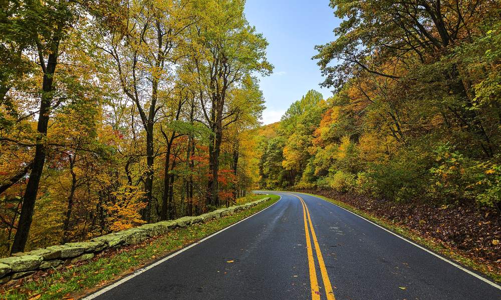
I have been early to the color more times than I have been on time, and late about as often. Early looks like August with a chill on it. Late is bare trees and a wet road. On time — the one week a whole hillside goes at once — is the best driving this country offers, and the only trick to it is timing. The leaves keep a schedule. It is looser than a train's, but it is a schedule, and you can plan a trip around it.
Two rules cover most of it. Color runs north to south, and it runs high to low. The far north and the high passes go first, in September. The valleys and the South go last, into November. Figure the high country a week or two ahead of the valley below it, and a few hundred miles of latitude is worth about the same. Everything else is weather — a wet summer holds the color back, an early frost brings it on, a windstorm at peak strips a mountain in a night. So the windows below are typical, not promised. Aim for the middle of one, and give yourself a day to slide.
The short version — typical peak, give or take a week
- Northern New England: last week of September in the far north, the first half of October through the middle of Vermont and New Hampshire, mid-October on the Maine coast.
- The Blue Ridge and the Smokies: the high ground early-to-mid October, the Parkway and Skyline Drive mid-to-late October, the valleys into the first week of November.
- The Upper Midwest: Lake Superior's shore late September into early October; lower Michigan, Ohio and Indiana mid-to-late October.
- The Rockies: aspen gold from mid-September to the first days of October — and the passes can close any day in October.
- The Eastern Sierra and the Cascades: the high lakes late September, the canyon mouths the second week of October; Washington's larch early-to-mid October.
- The Ozarks and the South: late October into early November, with Texas holding out to the middle of November.
Where the color is this week
as of October 6, 2026- 1New Englandlast week of Sept in the far north; first half of Oct through VT & NH; mid-Oct on the Maine coast
- 2Blue Ridge & Smokieshigh ground early to mid-Oct; the Parkway mid to late Oct; valleys into early Nov
- 3Upper MidwestLake Superior shore late Sept to early Oct; lower Michigan, Ohio & Indiana mid to late Oct
- 4The Rockiesaspen gold mid-Sept to the first days of Oct; passes can close any day in October
- 5Eastern Sierra & Cascadeshigh lakes late Sept, canyon mouths the second week of Oct; Washington larch early to mid-Oct
- 6The Ozarks & the Southlast week of Oct into early Nov; Texas Hill Country holds to mid-Nov
New England: where the calendar starts
Vermont, New Hampshire and Maine are where the country learned to chase leaves, and they still do it best. The Northeast Kingdom and the top of New Hampshire turn in the last week of September. The middle of Vermont — the Mad River Valley, the gaps, Route 100 end to end — runs the first two weeks of October. The Maine coast holds out until the middle of the month, which is why Acadia in mid-October is as good a week as that park has.
The roads: Vermont Route 100 the length of the state; the Appalachian Gap and Lincoln Gap out of Waitsfield; the Kancamagus Highway across the White Mountains, thirty-some miles of exactly what you came for, and packed on a peak Saturday; and the Park Loop Road in Acadia with Cadillac Mountain above it. Sleep midweek if you can. The inns around Stowe and Woodstock sell out months ahead for the peak weekends, and they know it.
Already planned: The Vermont Mad River Loop, two gaps in one day out of Waitsfield. Read up: Acadia, Bar Harbor, and Katahdin Woods and Waters for the far north.
The Blue Ridge and the Smokies: a month of it
The Appalachians run the longest show in the country because they have the most elevation to play with. Mount Mitchell, Grandfather Mountain and Newfound Gap — the ground above 5,000 feet — turn in the first half of October. The Parkway's middle elevations and Skyline Drive go mid-to-late October. The valleys, the foothills and Cades Cove finish late October into the first week of November. Start high and work down and you can drive peak for three weeks running.
The roads are the famous ones. Skyline Drive through Shenandoah, 105 miles at 35 miles an hour, which is the correct speed for it. The Blue Ridge Parkway from Waynesboro to Cherokee. Newfound Gap Road over the spine of the Smokies, the Cherohala Skyway, and the Dragon, which is better in October than on any summer weekend because the crowd has gone home. One thing to know before you go: as of this writing, about 29 miles of the Parkway between Linville Falls and Mount Mitchell are still closed for landslide repairs from Hurricane Helene, with the Park Service expecting the North Carolina stretch back by the end of 2026. Check the Park Service's road-closure page and plan the detour rather than discover it.
Already planned: The Ridgeline, the Blue Ridge Parkway, Tail of the Dragon and the Georgia Mountain Triangle. Read up: Shenandoah, Great Smoky Mountains, Asheville, Gatlinburg.
The Upper Midwest: Superior first
Lake Superior's shore goes early. The Keweenaw, the rest of Michigan's Upper Peninsula and Minnesota's North Shore turn in the last days of September and the first of October — Brockway Mountain Drive above Copper Harbor and Highway 61 from Duluth to Grand Portage are the drives. Lower Michigan waits until the middle of October: M-22 around the Leelanau Peninsula past Sleeping Bear, and the Tunnel of Trees on M-119 north of Harbor Springs, a narrow lane under a canopy and not a road to hurry. Farther south it is later still. Brown County, Indiana and Ohio's Hocking Hills are mid-to-late October, and both have roads that surprise people who think the Midwest is flat.
Already planned: the Hocking Hills Loop and the Limestone Loop through Brown County. Read up: Traverse City, Grand Portage, Cuyahoga Valley.
The Rockies: gold, on a short fuse
Out West the show is aspen, and aspen is gold — whole mountainsides of it, not the reds of the East. It is also quick. Colorado's high country runs from the middle of September to the first days of October, and a good year gives you maybe two weeks at peak. Maroon Bells above Aspen, Kebler Pass out of Crested Butte, Independence Pass, Guanella Pass and the San Juans along US-550 are the ones people cross the country for, and Trail Ridge Road in Rocky Mountain National Park has the Kawuneeche Valley on its west side turning at the same time. Wyoming's Tetons and the Snake River bottoms go the last week of September. Utah's Alpine Loop and Guardsman Pass, and Boulder Mountain on Highway 12, are late September into early October; so are the Enchanted Circle around Taos and the ski-basin road above Santa Fe. Up in the Black Hills, Spearfish Canyon's aspen and birch go in the same window, and it is the best fall drive on the Plains by a distance.
The catch is the calendar on the other side. Trail Ridge Road usually closes for the season by late October and Independence Pass in early November, but a real storm can shut either one for a day or a week any time in the fall, and the Million Dollar Highway is no place to be in the first snow. Look at the state's road site the morning you go, and keep a valley alternative in your pocket. Our field guide to seasonal pass closures has the typical dates for every road on this page.
Already planned: the Million Dollar Highway, The Roof of Colorado, The Painted Mile over Boulder Mountain, The Salmon Run through Idaho's Sawtooths, and the Black Hills Loop. Read up: Rocky Mountain, Estes Park, Taos, Park City, Capitol Reef, Deadwood.
The Eastern Sierra and the Cascades: aspen, then larch
California's best color is on the wrong side of the mountains for most of the state, which suits the people who know. US-395 down the Eastern Sierra passes canyon after canyon of aspen: Lundy Canyon and Conway Summit north of Lee Vining, the June Lake Loop, Rock Creek, and the South Lake and Lake Sabrina roads up Bishop Creek. The high lakes turn in the last week of September; June Lake and the canyon mouths follow in the second week of October, give or take. Hope Valley on Highway 88 south of Lake Tahoe is the same window, and it is the one Northern Californians drive to.
Washington does it with a different tree. The western larch is a conifer that turns gold and drops its needles, and for two weeks in early-to-mid October the North Cascades Highway — Washington 20 over Rainy and Washington passes — lights up with them. The highway closes for the winter, usually in November, but a snow year can bring that forward, so check before the drive. Glacier's larches in Montana go at the same time; the alpine section of Going-to-the-Sun closes for the season in the fall, sometimes early, so look at the park's road status rather than assume.
Already planned: the Three Flags Highway runs US-395 end to end, and the Cascade Loop has the North Cascades Highway. Read up: Yosemite for Tioga Pass down to the 395, Devils Postpile at Mammoth Lakes, Lake Tahoe, North Cascades.
The Ozarks and the South: the last show
When the rest of the country is raking, the South is just getting started. The Ozarks — the Pig Trail and Arkansas 7 through the Boston Mountains — peak the last week of October into the first of November. The Tennessee end of the Natchez Trace goes in the same window, and a parkway with no trucks on it is a good place to drive slow. Texas holds out longest: Lost Maples in the Hill Country turns its bigtooth maples red in the first half of November, and whole towns drive out to see it.
Already planned: the Ozark Pig Trail Loop and the Natchez Trace. Read up: Eureka Springs, Hot Springs, Nashville.
How to plan around it
- Plan the window, then the date. Pick a region above and aim at the middle of its window. The middle forgives a week either way; the edges don't.
- Use elevation as the dial. Early? Go up a couple thousand feet. Late? Drop into the valleys. The Blue Ridge and the Sierra each give you a month this way.
- Leave one day loose. The morning you planned for the pass may be fogged in, or the pass may be closed. A trip with a spare day finds the color. A trip without one drives past it.
- Book the night early and sleep midweek. Peak weekends in Vermont and the Smokies sell out months ahead. Tuesday in the same town is cheaper and has none of the traffic.
- Check the trackers the week of. Vermont, New Hampshire and Maine publish state foliage reports; the Smokies and the Parkway post color updates; Colorado's and Washington's road sites carry the pass closures. Five minutes the night before saves the drive.
- Go early in the day. Low sun through yellow leaves is the picture. It is also when the overlooks are empty.
Then the fun part
Once you know the region and the week, the rest is the part I enjoy: opening the map, picking the road, and lining the days up so you are on the pass in the morning and in a real town by dark. Load one of the Epic Trips above, set your date, and the planner spaces the days to how far you like to drive, puts the meals and the night where they belong, and hands the whole day to Google Maps when you are ready to roll. Run it in reverse for the way home. The leaves will do the rest, if you show up on time.
Change log
- October 6 — Weekly pass; six of the seven rows moved. Peak now covers Vermont’s Northeast Kingdom, Franconia Notch and the western White Mountains (90 to 95 percent on October 2) and northern Maine; Lake Placid is at peak with the rest of the Adirondacks near it, and the high Catskills are ahead of schedule at 75 to 80 percent in upper Windham. The Blue Ridge has finally started, about a week late, with the Parkway weekends called as October 9 to 11 and 16 to 18. The western U.P. and Wisconsin’s north woods are at peak, and Minnesota caught up in a week of cold mornings. In Colorado the peak has dropped to Kebler and Ohio passes while Gothic and the Slate River fade; no dated report was found for the San Juans, Independence or Guanella since the late-September storm, and the row says so. The Sierra peak is moving down-canyon, with Monitor Pass and Hope Valley rated go-now, and the Washington larches are within days of peak. The South has not started. The Yosemite smoke note and the September 25 Teton line are out, with nothing newer to stand them on.
- September 28 — Weekly pass; every region but the South moved. The far north of New England is at peak (Vermont’s Kingdom “approaching peak,” Maine 30 to 70 percent, the White Mountains 30 with frost); Whiteface is 55 percent and near peak with Tupper Lake at 50 to 55; the Blue Ridge is still green and now measurably late after a September 4 to 6 degrees above normal, with the 5,000-foot summits given ten more days; the western U.P. is in its window and Minnesota’s North Shore is 25 to 50; Crested Butte’s valleys are at peak with a Colorado snow-and-wind storm due September 28 and 29 that should strip the high stands, and the first dated Teton report is in; Bishop Creek and the Mono high groves are at peak with the Washington larches a week out. The Smokies sentence that cited a September 18 park report is gone: the page no longer exists and the claim could not be re-verified. Drought note added for the Ozarks. Four of the foliage-report pages this box is checked against moved or died this week; the register now points at the live ones.
- September 21 — Added the where-the-color-is box, dated and refreshed weekly through the season from the state and park foliage reports: New England, the Adirondacks and the Upper Midwest just starting; the Blue Ridge and Smokies behind schedule on a hot September; Colorado early, muted by drought and at or near peak in the high valleys; Bishop Creek near peak; the larches two weeks out; the South not started. Weekly-update banner added.
- August 26 — Published.