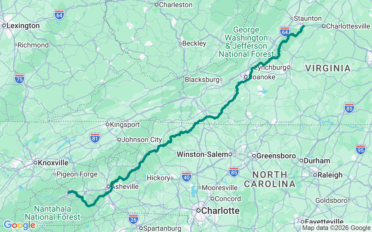
Northbound — start in the drama of the Smokies, finish with gentler Virginia countryside
Forty-Five and Falling
Four hundred and sixty-nine miles, forty-five miles an hour, and not one traffic light. Do the math: this is a road built specifically to make you slow down.
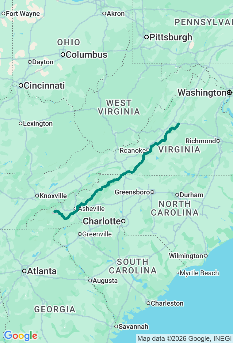
The Blue Ridge Parkway runs the spine of the southern Appalachians from the Smokies to Shenandoah — no billboards, no commercial trucks, no stoplights, just mileposts and overlooks and a speed limit that's really more of a philosophy. Heading north, you'll count the posts down from 469. Three days is the honest minimum, and even that's a forced march, because the parkway pays out in proportion to how much you dawdle. Two things to plan around: there's no gas on the parkway itself, so fuel in the towns, and sections close without much warning for ice and fog — check the Park Service road map before each leg.
Day one starts at the southern end in Cherokee with a giant riverside breakfast at Peter's Pancakes — fluffy stacks, friendly, cheap, the right fuel for a slow day. Climb to Waterrock Knob, the parkway's highest visitor center at fifty-eight hundred feet, for a near-360 sweep across four mountain ranges. Pull off at Graveyard Fields, an open high meadow — named for the storm-felled, fire-blackened stumps that once stood like headstones — with easy waterfalls and, come late summer, wild blueberries you're allowed to pick. Then drop into Asheville for inventive Southern-leaning plates at Copper Crown and a comfortable night at the Homewood Suites off Tunnel Road, with the liveliest little city in the mountains at your doorstep.
Day two opens with a Cuban breakfast at Guajiro — a cafecito and a real Cuban sandwich at a downtown counter — before the spur up Mount Mitchell, at 6,684 feet the highest peak east of the Mississippi, with a ramped summit deck and a forty-degree chill against the valley heat. Back on the parkway comes the engineering marvel: the Linn Cove Viaduct, a quarter-mile of road threaded on stilts around Grandfather Mountain so the slope beneath stays untouched — the very last piece of the parkway to be finished, in 1987, fifty-two years after the first shovel. Stretch your legs at Doughton Park, the largest recreation area on the road, then reach Mabry Mill — the most photographed spot on the whole parkway, a water-wheeled gristmill with a millpond and living-history demos (the famous restaurant has closed, so come for the mill and the weekend music, not the pancakes). A quick look at Rocky Knob, then duck off to tiny, artsy Floyd for wood-fired pizza and live music at the Dogtown Roadhouse, and a themed room at the cheerfully green Hotel Floyd.
Day three is the parkway's gentlest. After a hearty mountain breakfast, settle in for lunch at the Peaks of Otter Lake View Restaurant, with Abbott Lake and the pointed cone of Sharp Top filling the windows; the lakeside Peaks of Otter Lodge is one of the iconic addresses on the road. Drop to the James River Visitor Center — at 649 feet, the lowest point on the entire parkway — for a footbridge over the river and a restored canal lock. Then leave the ridge for Waynesboro and a very good dinner at The Green Leaf Grill — New Orleans by way of the Shenandoah Valley, and routinely the best-reviewed table in town — before a last comfortable night at the Residence Inn. You finish at Rockfish Gap, where the parkway hands you straight off to Skyline Drive. If three days only whetted it, there are another hundred miles waiting to the north.
And hold the milepost schedule loosely — this road practically begs you to. Half its magic is the overlook you weren't going to stop at, the gravel side road into a cove of rhododendron, the bluegrass leaking out of a country store on a Friday night. The plan is a backbone, not a cage; it's here so you can wander off it without missing your bed by midnight. On a road this unhurried, the best stop is almost always the one that wasn't on the list. Pull into it.