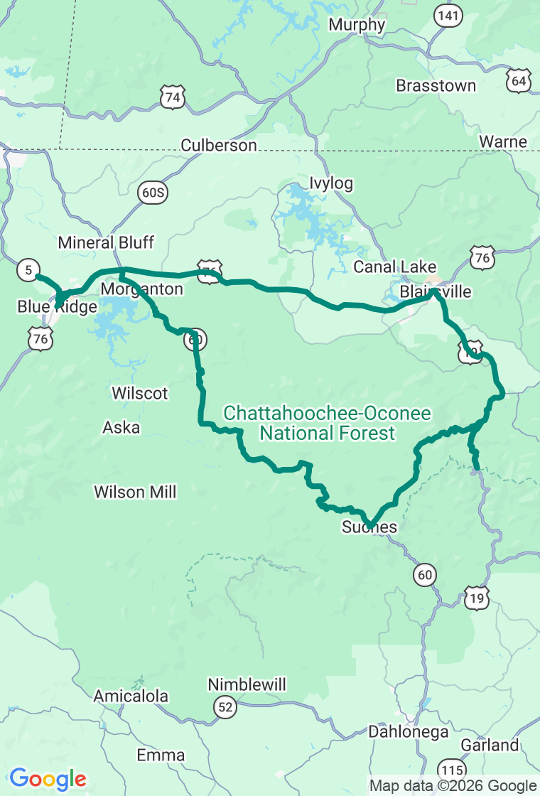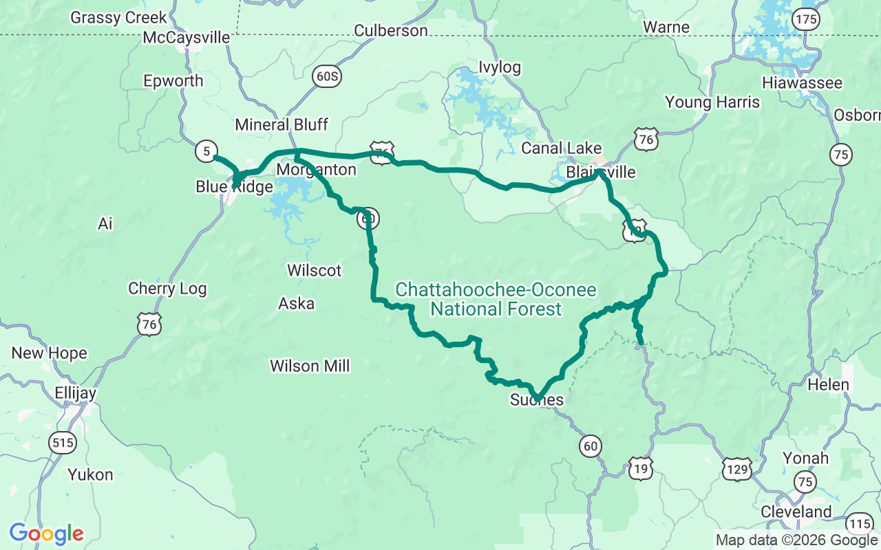
Clockwise — Wolf Pen Gap first, drop south to Dahlonega, back up via GA-60
Lean Into the Triangle
Three mountain roads, one valley above the clouds, and about a hundred and fifty miles of reasons to lean.
North Georgia's 'triangle' — GA-60, GA-180, and the Richard Russell Scenic Highway (GA-348), all radiating from the tiny rider hub of Suches — is the Southeast's answer to a mountain pass: a hundred and fifty miles of switchbacks, sweepers, and gaps through the Chattahoochee National Forest. Wolf Pen Gap Road (GA-180) is the tightest and most technical, often called the curviest in the state, and Suches sits at three thousand feet, the 'Valley Above the Clouds.' Ride it on a weekday if you can — weekends bring riders and leaf-peepers in equal number — watch for deer, gravel in the apexes, and wet leaves in fall, and save the big descents for a dry day.
Start on the Blairsville square with coffee and the locally famous cheesy grits at Cabin Coffee Co. — an easy place to stage the morning.
Roll up to Mountain Crossings at Neels Gap, the historic stone building the Appalachian Trail walks straight through — the only spot on the entire 2,000-mile trail that happens, with a tree out front hung with the boots of hikers who've called it quits. Even on two wheels, it's a required stop. Drop into Vogel State Park at the foot of Blood Mountain — Georgia's highest point on the AT at forty-four hundred feet — one of the state's oldest parks, all CCC stonework around a little lake.
Then the heart of it: Suches, and Two Wheels of Suches, the motorcycle campground and cafe at the crossroads of the best roads in the region. Time it for a weekend and the kitchen's open and the lot's full of bikes. Swing by Mercier Orchards near Blue Ridge — a four-generation apple farm famous for fried pies and cider donuts that alone justify the parking lot.
Wind down with a farm-to-table dinner around Blairsville at The Sawmill Place (check the hours — it can run daytime-only), or just pull into Copperhead Lodge & Resort and eat in at its Flying Trout. Copperhead is where you'll want to sleep anyway: a moto-built resort with covered bike parking, private garages at the cabins, and owners who'll happily point you at the next day's roads.
And hold it loosely — the triangle is ringed with roads that aren't on the plan. The plan's a backbone, not a cage, and these mountains are full of reasons to wander: a forest road to a waterfall, a gap with a view that stops you cold, a country store with a porch made for a long lunch. Wander, by all means — just keep your eyes up for deer on the curves, mind the gravel and the wet leaves, and don't let a clear morning talk you into trusting a shaded switchback. The best stop up here is the one nobody wrote down. Go find it.