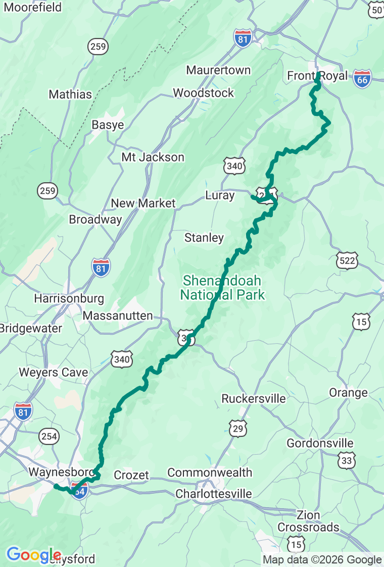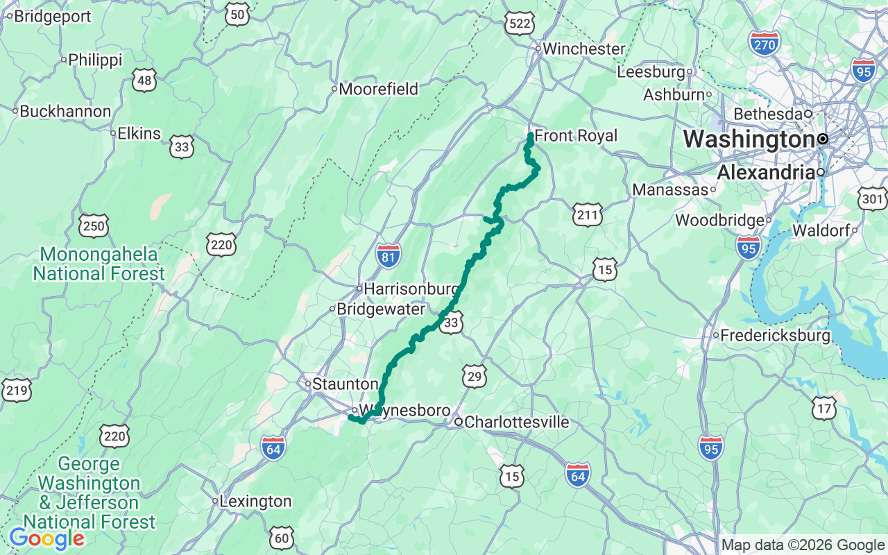
Southbound — drop south down the ridgeline from Front Royal, finishing above Waynesboro
The Point Is the Drive
A hundred and five miles, thirty-five miles an hour, and seventy-five places to pull over. Skyline Drive isn't a route between two points — it's the point.
Skyline Drive is the only public road through Shenandoah National Park, running the crest of the Blue Ridge for its entire hundred-and-five-mile length. Thirty-five the whole way, an entrance fee at the gate, more than seventy-five overlooks, and a near-certainty of deer standing in the road at dusk. It's a slow, civilized ridge cruise, built by the Civilian Conservation Corps in the thirties and finished in 1939, and at its south end it hands you straight onto the Blue Ridge Parkway — five hundred-plus continuous miles of mountain road if you've got the days. Plan around two things: the crest runs much cooler and foggier than the valley towns at either end, and sections close for ice in winter and can stay shut for days after a storm.
Start in Front Royal at the Main Street Daily Grind for a made-to-order breakfast and a real coffee before the north gate.
The first big payoff is the Hogback Overlook at milepost 20.8 — the longest overlook on the Drive, curving along the ridge so the view sweeps a wide arc of the Shenandoah River's bends and the valley beyond. The classic.
Re-center at Thornton Gap, one of the four entrance stations, with restrooms and the trailhead for Mary's Rock if you feel like earning a summit. Then stretch your legs at the Stony Man overlook — the park's second-highest peak at 4,011 feet, with one of the best effort-to-reward hikes anywhere: a mile and a half, a few hundred feet up, and a west-facing perch over the whole valley.
Big Meadows, at milepost 51, is the hub of the park: the Byrd visitor center, the wayside, the one in-park gas station (top off here — and there's EV charging at the visitor center), and the famous open meadow where the deer graze like they're posing and the spring wildflowers run riot.
Roll off the south end at Rockfish Gap into Waynesboro for dinner at The Green Leaf Grill — Creole-leaning, from-scratch, routinely the best table in town (closed Sunday and Monday) — and a comfortable night at the Residence Inn. From here the Parkway picks up exactly where the Drive leaves off, if three days from now you find you're still not finished.
And hold the milepost plan loosely — at thirty-five miles an hour, you've got nothing but time. The best of Skyline is rarely the overlook you circled: it's the doe and fawn in the meadow at golden hour, the unmarked pull-off where the fog peels off the valley like a curtain, the trail you take on a whim. The plan's a backbone, not a cage. On a road this unhurried, just pull into the view that wasn't on the list.