Westbound — descend from Capitol Reef, formations build dramatically toward Bryce
Utah 12 Doesn't Repeat Itself
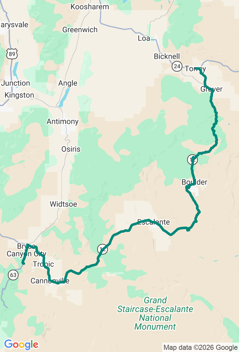
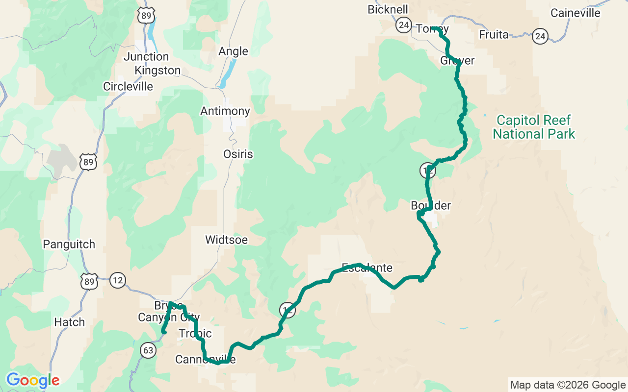
A hundred and twenty miles that climb a forested mountain, run a knife-edge of slickrock, and finish among the hoodoos. Utah's Highway 12 does not repeat itself.
Scenic Byway 12 is the only All-American Road in Utah and one of the most varied drives in the country — in a single day it goes from the aspens atop Boulder Mountain to a red-rock spine barely wider than the pavement to the orange amphitheater of Bryce Canyon. Run it east to west and it starts near Capitol Reef and ends in the hoodoos. The road's paved and open year-round, but the Boulder Mountain stretch ices over in winter and pieces of it are under construction into 2026, so check conditions first. The one thing to build your day around is the Calf Creek hike: it's the biggest commitment of time and effort on the route, and the desert heat is not a suggestion.
Start in Torrey at the Wild Rabbit Cafe — organic coffee, house pastries, a breakfast burrito — and fill the tank; services thin out fast once you climb.
The road climbs Boulder Mountain to nearly ninety-six hundred feet, the high point of the whole byway, through aspen and conifer that feel a continent removed from the desert below. Pull off at the Larb Hollow Overlook, an easy paved crescent with a hundred-mile view east across the Waterpocket Fold to the Henry Mountains.
Drop the west side and the famous Hogback arrives — a stretch where the road runs a narrow ridge of slickrock with the ground falling away into canyon on both sides. No guardrails, no shoulders, no reason on earth to hurry.
Pull in at Lower Calf Creek Falls in the Grand Staircase-Escalante and decide whether you've got it in you: a six-mile round trip through deep, ankle-grabbing sand to a hundred-and-twenty-six-foot waterfall pouring into a desert oasis, with Fremont rock art on the canyon walls along the way. It's the best thing on the road and the hardest — carry far more water than you think you need, and go early.
Wind on through Escalante and down toward Bryce. Dinner is the dining room at the historic Lodge at Bryce Canyon, a 1925 log-and-stone landmark — no reservations, classic park fare, so get there before the rush. Then sleep a few minutes downhill in Tropic at the Steppingstone Inn, a small owner-run place walkable to dinner and ten minutes from the Bryce rim — close enough to be back at the amphitheater for sunrise, which is the only correct way to see it.
And hold the plan loosely — Highway 12 hands you a hundred excuses to. The plan's a backbone, not a cage: the slot canyon down a dirt spur, the slickrock dome with nobody on it, the diner in a town of two hundred. Wander, by all means — just carry water like the desert means it, watch the afternoon monsoon stack over the plateau in late summer, and never, ever walk into a slot canyon when there's weather upstream. The best stop out here is the one that wasn't on the list. Go find it.