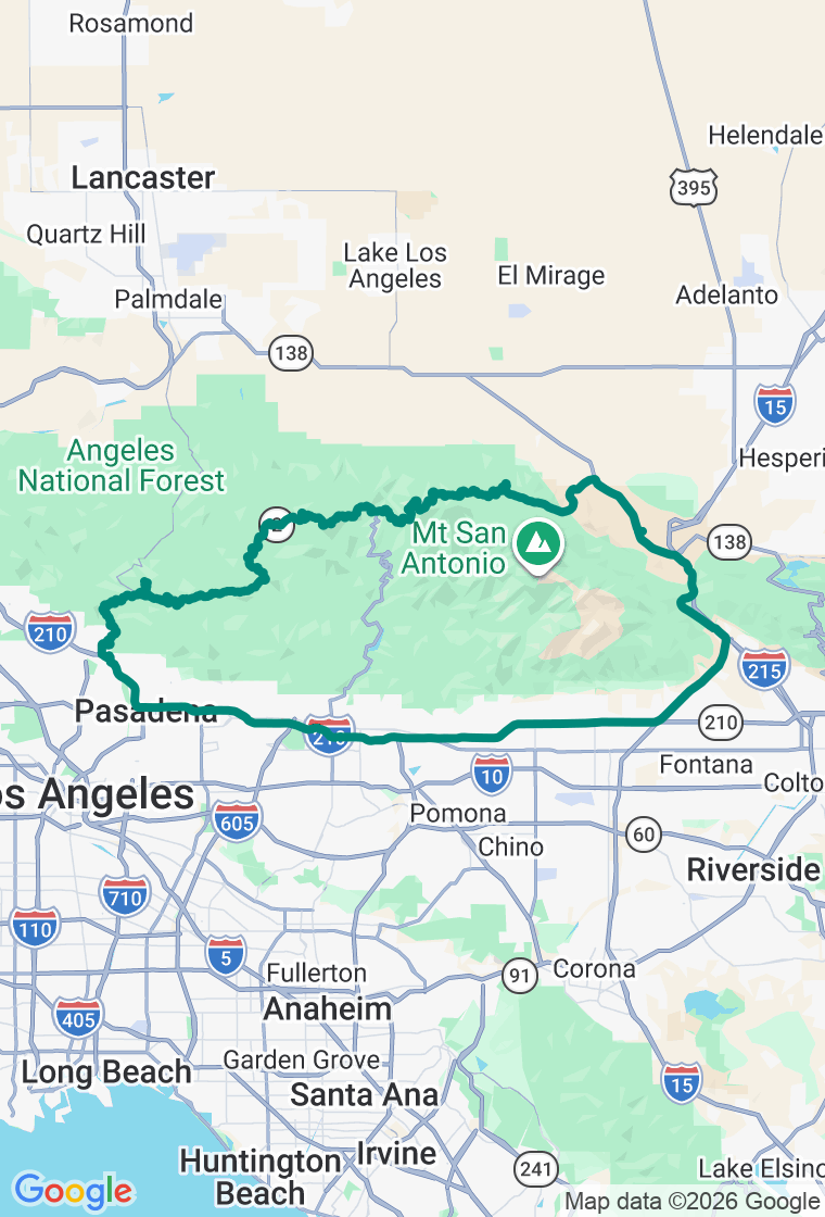
Clockwise — CA-2 east through the mountains, return via CA-138 through the high desert
Ride It Sharp, Not Fast
Sixty-six miles of curves strung between the city and the desert — and the discipline to ride them like you plan to come back.
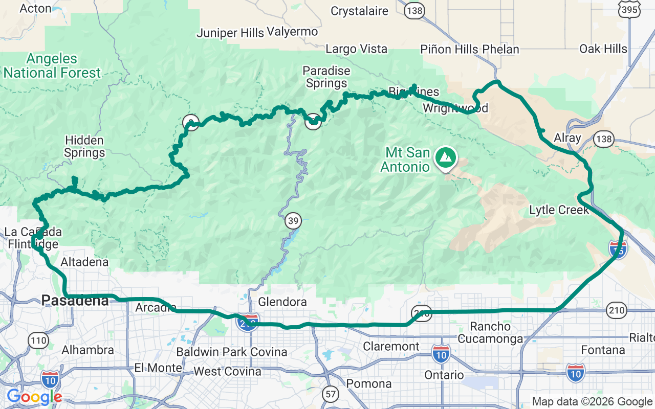
The Angeles Crest Highway climbs SR-2 out of the LA basin into the San Gabriels, near-continuous corners up to almost seventy-nine hundred feet, the city falling away on one side and the Mojave opening on the other. It's one of the great driving roads in California and one of the most dangerous: the large majority of LA County's fatal motorcycle wrecks happen up here, and they happen almost entirely to people who came in too hot. Ride it sharp, not fast. Two honest caveats before you commit: the upper stretch gates shut for snow each winter, and the highway gets closed by fire and storm damage with maddening regularity — a 2025 storm had a long section shut indefinitely — so check Caltrans QuickMap the morning you go. You may be running a glorious out-and-back rather than the full loop.
Start with the breakfast burrito at Old Town Caffe, an unhurried little upstairs café on Colorado Boulevard in Pasadena (the name's just a name — it sits east of the actual Old Town, but the burrito's worth the address either way). Fill the tank while you're down in the flats; there's no fuel for the next sixty miles up the mountain.
Spur up to the Mount Wilson Observatory at fifty-seven hundred feet, where the 100-inch Hooker telescope is the instrument Edwin Hubble used to prove the universe runs well past the Milky Way — and that it's still getting bigger. You can walk into a working dome, and the drop off the mountain throws the whole basin at your feet.
Higher into the pines, pull in at the Chilao Visitor Center, a mile-high Forest Service outpost with interpretive exhibits, a couple of short leg-stretch trails, and some of the best high-country birding on the mountain (the building keeps weekend hours, but the grounds and the big San Gabriel views don't clock out). It sits about a mile west of Newcomb's Ranch — for decades the only roadhouse on Angeles Crest and the unofficial clubhouse for every rider on it, shuttered since 2020 — which leaves Chilao just about the last real stop up here. Tip your helmet as you pass the old place.
Near the top, Inspiration Point is a high overlook on Blue Ridge close to seventy-four hundred feet, with old pipe 'locating tubes' aimed at the named peaks — Mt. Baldy, the Mojave spreading out to the north, Catalina on a clear day — and the Pacific Crest Trail crossing the road at your boots.
From there the loop turns for home, dropping off the back of the range and swinging through the foothills back to Pasadena — where dinner waits at Nick's on South Lake Avenue, an upscale-casual supper club that's the right kind of reward after a day of being thrown around the mountain: a filet or the cioppino and the warm butter cake everyone tells you to order.
And ride it like the road, not the clock. The plan is a backbone, not a cage — but on Angeles Crest the smartest wandering is the kind that keeps you breathing: roll off when a blind, decreasing-radius corner tightens, let the squids who came in hot vanish up the canyon without you, and pull into the overlook nobody's standing at. The mountain isn't going anywhere, and with any luck neither are you. The best stop is simply the one you actually stop at.