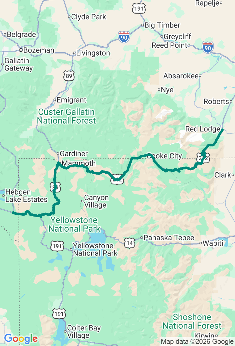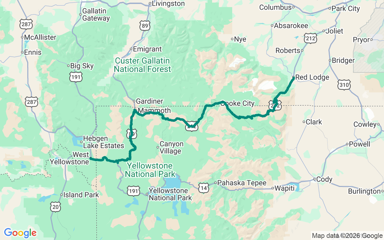
Start in West Yellowstone and cross Yellowstone to the northeast — Madison, Norris, Mammoth, Tower and the Lamar Valley — out the Northeast Entrance at Cooke City, then climb US-212 over Beartooth Pass and down the switchback wall into Red Lodge
The Roof of the Rockies
There's a stretch up top where the trees quit, the road stops pretending to follow the land, and you're just driving across the roof of the Rockies.
The Beartooth Highway runs about sixty-eight miles between Cooke City and Red Lodge and spends the best of them above ten thousand feet — a treeless tundra plateau of bare rock and half-frozen lakes that has no business being reachable by car. Charles Kuralt called it the most beautiful drive in America, and nobody's mounted a serious rebuttal since. Like Glacier, it keeps a short calendar: open roughly Memorial Day to mid-October, and willing to throw snow at you in July, so check Montana DOT the morning you go.
Start with a big breakfast in West Yellowstone, the west-gate town, then cross the top of the park to Cooke City, the tiny seasonal outpost at the foot of the pass — and here's the one that actually matters: fill the tank in Cooke City before you climb. There is no guaranteed fuel for the next sixty-odd miles over the top. Don't gamble on it.
Climb out and the show starts. The Top of the World Store is exactly what it sounds like — a lonely general store near 9,400 feet that's the only commerce for miles, good for a cold drink, a sticker, and the small thrill of buying anything this far up. Higher still, pull off at the Beartooth Pass Vista: 10,947 feet at the summit, snowbanks against blue sky in the dead middle of summer, marmots and mountain goats working the rocks. Bring a layer — it can sit in the forties up here in July while the valley bakes.
Wind the famous switchbacks down the Red Lodge side and land at the Red Lodge Cafe & Casino, a Western diner that's been feeding travelers under old neon for generations. Get the breakfast-all-day and a slab of pie, and don't expect to be hurried.
Sleep at The Pollard, Red Lodge's first brick building — an 1893 hotel that once put up Buffalo Bill and Calamity Jane and still trades on every creak of its history. After a day on the roof of the range, a room with a hundred and thirty years of stories in the walls feels about right.
And hold the plan loosely up here, because the mountain holds the cards. The pass can be sunny at the bottom and a whiteout at the summit; the lake you didn't plan to stop at will be the one still half-frozen and glowing; the best overlook is rarely the one with a sign. The itinerary is a backbone, not a cage — it's here so you can wander off it without ending up stranded above treeline at dusk. When a pullout opens on an alpine basin with no one in it, that is the trip. Get out of the car.