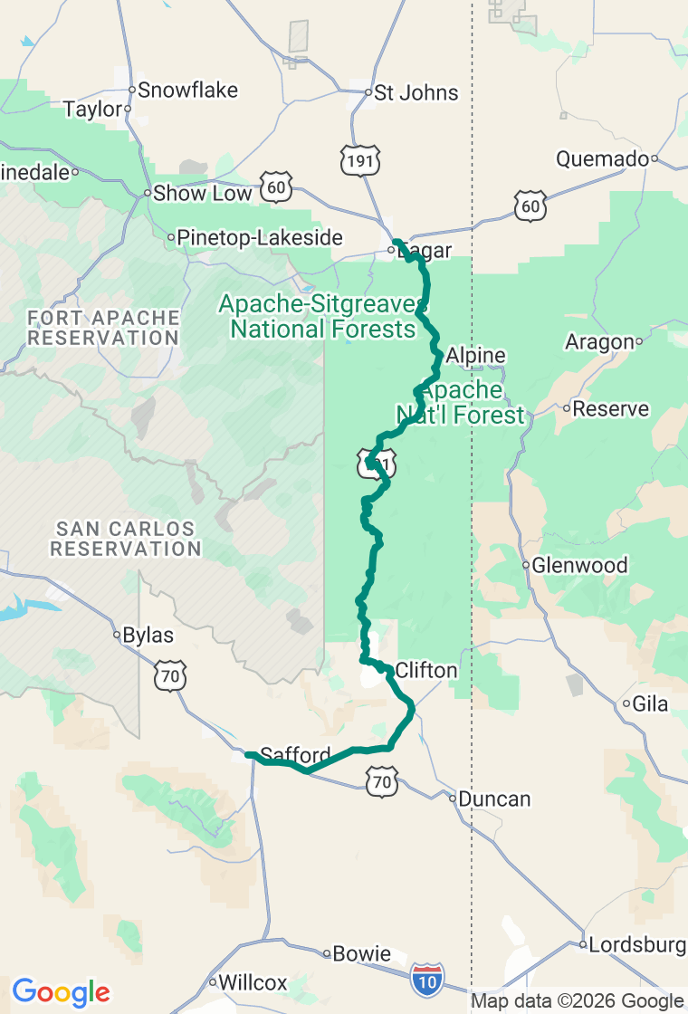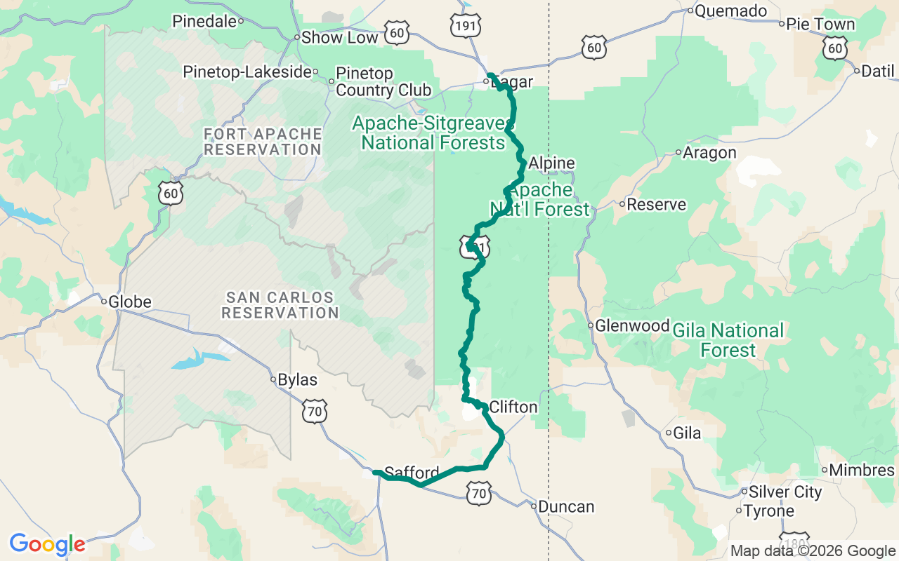
Northbound — leave Safford and climb the Coronado Trail's 460 curves up into the White Mountains
Desert Pit to Nine Thousand Feet
From a copper pit in the desert to nine thousand feet of spruce and aspen — on a road with more curves than anyone counts the same way twice.
The Coronado Trail — US-191 through Arizona's White Mountains — is one of the curviest, emptiest, most underrated drives in the country. It climbs from the Sonoran desert at Clifton, around the rim of a copper mine the size of a city, up through every life zone Arizona has to the spruce and aspen of the Mogollon Rim. It's named for the conquistador who came through in 1540 chasing cities of gold; for decades it wore the route number 666 and the nickname 'the Devil's Highway' before it was renumbered to 191. The figure that matters most, though, is zero — as in roughly ninety miles with no fuel and no cell signal. Fill the tank, feed the body, and don't start late. In winter the high stretch is plowed only on weekdays, so treat this as a late-spring-to-fall road.
Eat a real breakfast in Safford — Jerry's, a 1950s diner right on the main drag, does it — then run US-191 north some thirty-odd miles to Clifton and top off; the next reliable services are most of a day away.
The first spectacle is the Morenci Mine — the largest copper mine in the United States, a terraced open pit the highway literally threads through, moving something like seven hundred thousand tons of rock a day. (The public tours are gone; you take it in from the overlooks as you pass.)
Then the road stands up on its hind legs. Pull off at the Blue Vista Overlook, perched on the very edge of the Mogollon Rim near ninety-two hundred feet, the whole desert you just climbed out of spread below you toward the Pinaleños. A bit farther sits Hannagan Meadow Lodge, a century-old lodge in a meadow at ninety-one hundred feet — the only food, fuel, or bed for many miles in either direction, no cell signal, woodstoves and dark skies. Even if you don't stay, it's the heartbeat of the high country.
Drop toward Alpine for lunch at the Bear Wallow Cafe — green-chile breakfast burritos and honest burgers, the dependable real-food stop in a remote town. Dinner down the road at Trailriders in Eagar, a hearty family steakhouse-and-Mexican spot. Then sleep at The Ranch at South Fork, a handful of cabins on the south fork of the Little Colorado with a stocked trout pond — the quiet you've earned after a day of switchbacks.
And hold it loosely — out here you'll have the road to yourself to do it. The plan's a backbone, not a cage, and the White Mountains are full of reasons to wander: a forest road into the aspens at the first gold of October, a meadow full of elk at dusk, a fire lookout you can climb. Just keep track of where the fuel is and isn't, watch for elk on the curves at dawn, and keep an eye on the afternoon monsoon stacking up over the Rim in late summer. The best stop out here is the one nobody else bothered to drive this far to find. Go find it.