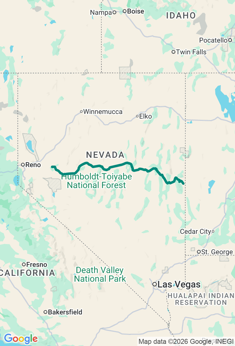
Eastbound — ride away from the Sierra into the empty heart of the Great Basin toward Great Basin National Park
Survive the Loneliest Road
They named it the loneliest road as a warning. Nevada printed it on a sign.
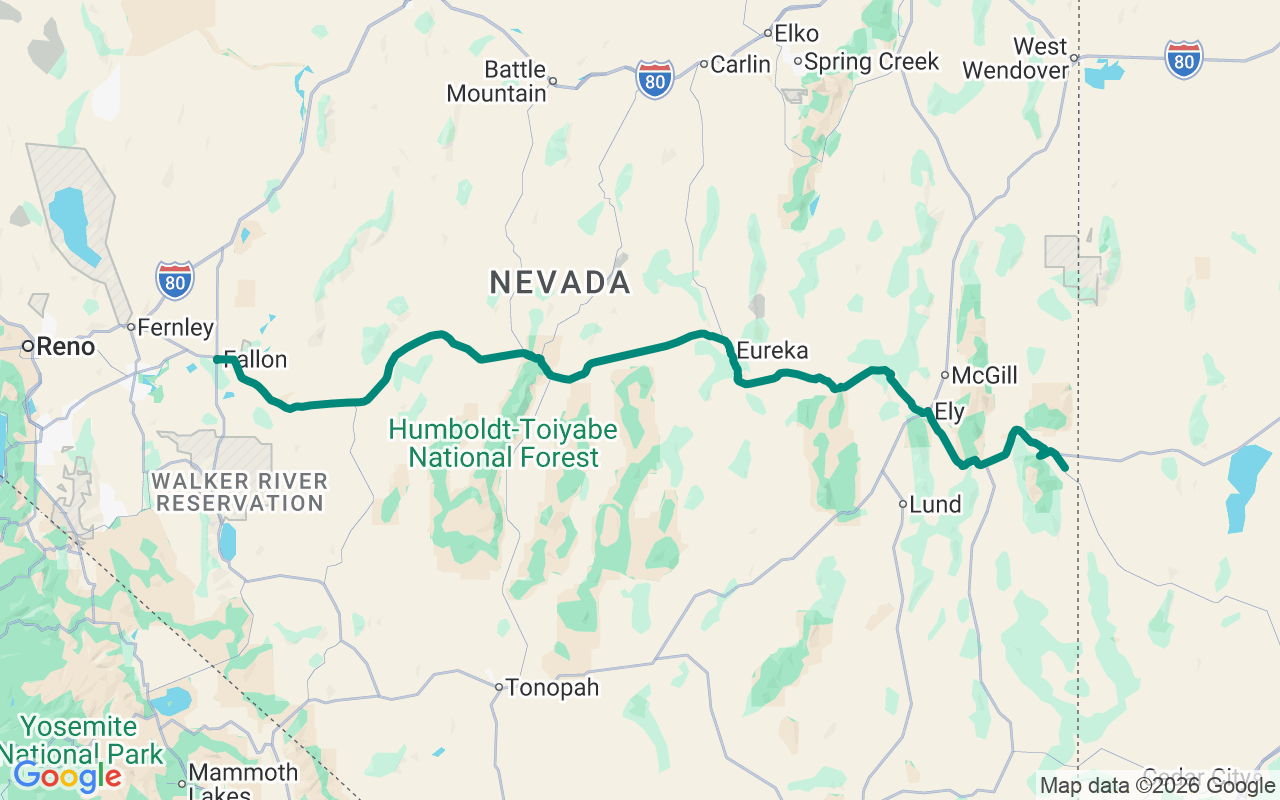
In 1986, Life magazine called this stretch of US-50 across Nevada 'the Loneliest Road in America' and quoted AAA telling travelers not to attempt it without 'survival skills.' Nevada, sensing an opportunity, turned the insult into a slogan — there's even an official Survival Guide passport you get stamped in the towns along the way and mail in for a certificate proving you made it. The road crosses seventeen mountain passes and the wide empty basins between them, riding the bones of the Pony Express and the Lincoln Highway, with exactly three towns in four hundred miles. It's a day about big distance and bigger sky: fuel up at every town, carry water, and respect the daylight.
First meal in Fallon at The Slanted Porch, a converted house with a porch and genuinely good food (check the hours — it leans toward lunch). Top off, then head east into the empty.
Twelve miles out, Grimes Point — a field of nine hundred black basalt boulders carved with petroglyphs going back thousands of years, an easy quarter-mile loop into deep time.
A hundred-odd lonely miles on is Austin, an old silver camp clinging to a canyon. Fuel at Champs, then climb the hill to Stokes Castle — a three-story granite tower a mining baron built in 1897, modeled on one he'd admired in Italy, lived in for about a month, and walked away from. It stands there still, roofless, staring out over the Reese River Valley — the perfect monument to this whole magnificent, slightly mad stretch of road.
Lunch in Eureka, the self-styled 'friendliest town on the loneliest road,' at the Urban Cowboy, where the menu runs from burgers to chicken tikka masala, because out here you take good food however it comes. Fuel again in Ely — the last real services before the long run to the state line.
Finish at Great Basin National Park, one of the least-visited and most astonishing parks in the country: a thirteen-thousand-foot peak with Nevada's only glacier, marble caverns, bristlecone pines five thousand years old, and some of the darkest skies left in America. Sleep a few miles out at the Hidden Canyon Retreat near Baker, down a dirt road with no cell signal and a sky absolutely loaded with stars.
And hold the plan loosely — on the loneliest road, the wandering is the whole point. The plan's a backbone, not a cage: the ghost town down a dirt spur, the Pony Express ruin out in the sagebrush, the hot spring steaming in an empty valley. Out here the emptiness isn't something to endure — it's the attraction. Just keep the tank ahead of the next town, carry more water than you think you need, and watch the light, because there's nobody out here to bail you out. The best stop on this road is the one that isn't on any map. Go find it.