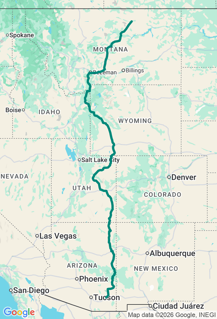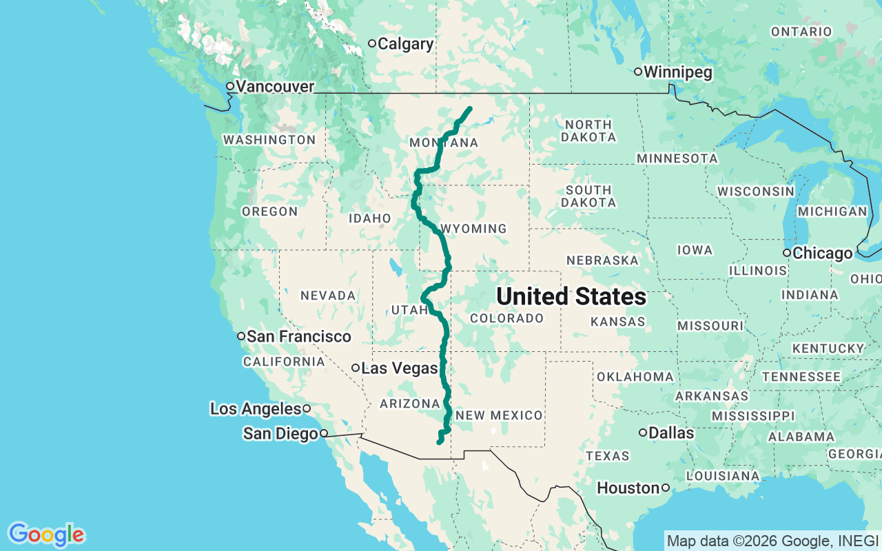
Northbound — run US-191 the length of the West, from the high desert around Willcox up the Coronado Trail and across the Rockies to the Montana high plains near the Canadian line.
The Western Spine
Nobody drives it straight through. That would take sixteen hundred miles of discipline nobody actually has, and the road itself makes the argument for dawdling -- it keeps handing you reasons to stop, and the reasons keep getting better.
US-191 is the longest single highway you have probably never thought of as a road trip. The road runs from the Mexican border at Douglas, Arizona all the way to the Canadian line in northern Montana; this run picks it up at Willcox and heads north, threading through four states and every major terrain type the American West has to offer: desert, canyon country, high plains, Rockies, and the broken badlands of the Missouri Breaks. The southern half was Route 666 until Arizona tired of replacing stolen signs in the early nineties and quietly asked for a new number. The road kept every curve.
From Willcox, day one climbs straight into the Coronado Trail -- 120 miles of US-191 between Clifton and Springerville that contains 460 curves, reaches 9,190 feet at Blue Vista, and has no passing lanes, no guardrails in places, and speeds that drop to 10 mph through the sharpest switchbacks. John Wayne reportedly said it was the most beautiful drive in America; he was probably right, though he didn't have to follow an RV the whole way. The Blue Vista Scenic Overlook sits on the Mogollon Rim escarpment -- a geological feature so dramatic that Arizona ranks it second only to the Grand Canyon. The view looks out over folded mountains stacked into Mexico. Top off before Clifton. The next reliable fuel is a long way up.
Day two crosses into Utah and the Colorado Plateau, where the color of everything shifts from the greens of the Apache-Sitgreaves to the deep reds and tans of canyon country. Twin Rocks in Bluff -- the twin sandstone spires the Navajo call the Navajo Twins -- mark your evening landmark and give you an excuse for a Navajo Taco at the cafe built literally in their shadow. The next morning, Church Rock and Wilson Arch flank the highway south of Moab. Wilson Arch has a 91-foot span and rises 46 feet above the highway; it's five minutes off US-191 and nobody has made you pay to see it yet.
By Day four you've climbed back into Wyoming's high desert and earned Flaming Gorge. The reservoir fills 91 miles of former Green River canyon, walls the color of cinnabar in afternoon light, with pronghorn on the sagebrush benches above. US-191 is designated an All-American Road here. Rock Springs makes a pragmatic overnight before the big Day five push into the Tetons.
Hoback Canyon is the gateway. Highway 189/191 descends through a canyon whose walls rise six hundred feet above the river -- clear water, bighorn sheep on the scree, the kind of drive that makes the last hundred miles of flatland worthwhile. Jackson sits at the canyon's north end with the Grand Tetons right there, no effort required. The Tetons are the youngest range in the Rockies and their geology shows it: abrupt, unapologetically vertical, the kind of skyline you feel before you properly see it.
Day six runs the Gallatin Canyon -- US-191 threading between the Madison and Gallatin ranges, hugging a Blue Ribbon trout stream that starred in A River Runs Through It, then climbing through Big Sky country toward Bozeman and the Yellowstone gateway. It's a long day with scenery that refuses to let up, and Lewistown is a worthy overnight before the final push.
Day seven crosses the Missouri Breaks. The Fred Robinson Bridge at milepost 88 on US-191 was, when it opened in 1959, the only Missouri River crossing for 250 river miles. Once over, the highway climbs out of the breaks onto the high plains and the landscape opens into the vast, flat, cattle-country northern tier where the light goes on forever and the Canadian border is 125 miles up and feels exactly that far. Malta is your finish -- a ranch town on the Hi-Line that doesn't care much about being the end of a famous road, which is probably exactly the right attitude.
Carry this loosely. The Coronado Trail will eat your schedule if the switchbacks are icy or the clouds roll in at nine thousand feet, and that's fine -- Hannagan Meadow is a better place to wait out weather than most towns are to pass through. On the Utah stretch, the arches visible from the highway are the ones nobody walks to, and the ones worth finding aren't on the sign. And the Fred Robinson Bridge on Day seven is the kind of stop that doesn't photograph well and doesn't need to. The plan is a spine, not a cage -- wander off it anytime the road suggests you should, and it will suggest this a lot.