Southbound — ride toward the end of the continent, ocean closing in on both sides
Where the Shoulder Is Ocean
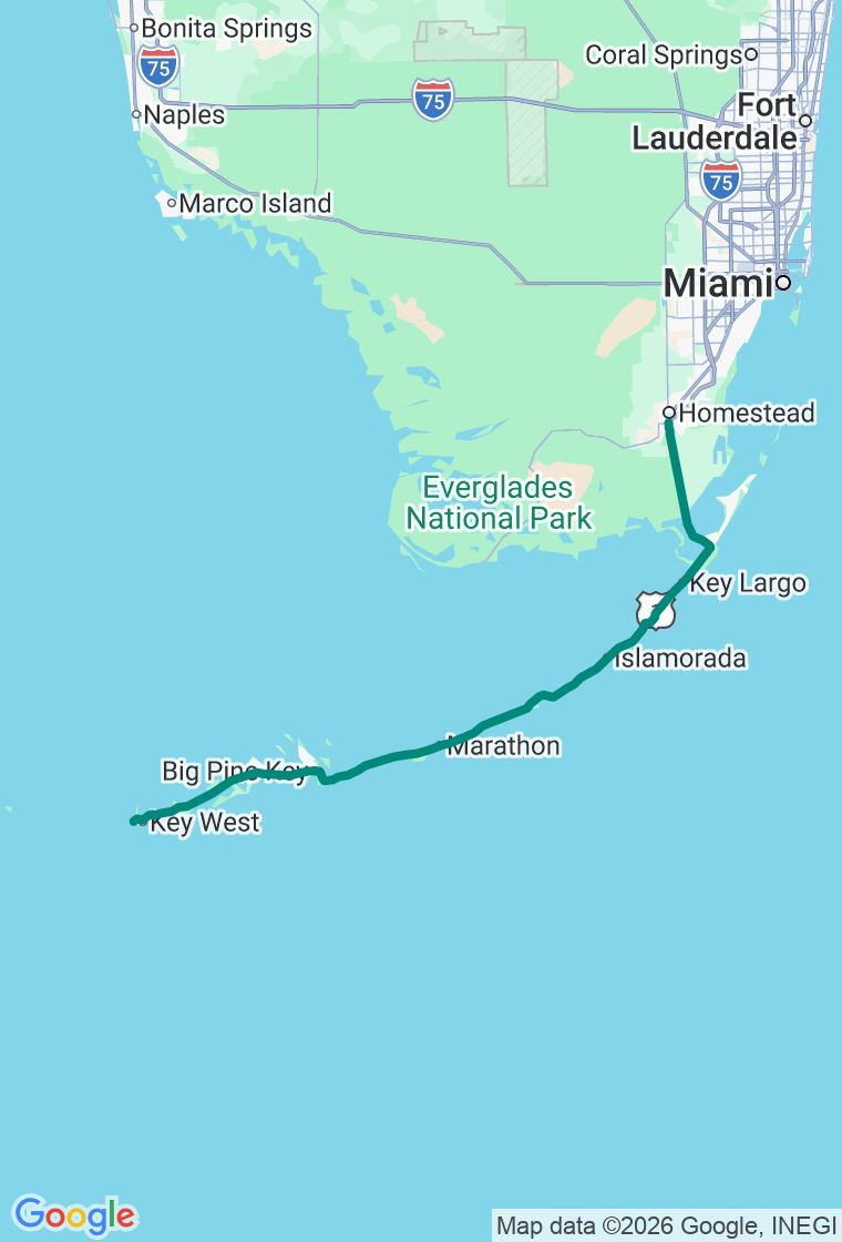
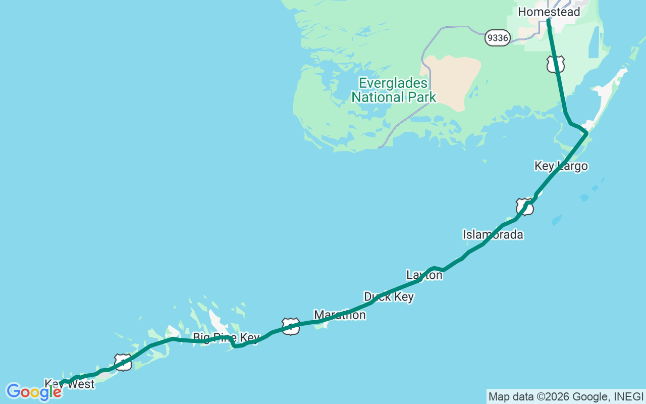
A hundred and thirteen miles of highway, forty-two bridges, and a whole lot of ocean where the shoulder ought to be.
The Overseas Highway runs US-1 down the Florida Keys from the mainland to Key West — island-hopping across forty-two bridges with the Atlantic on one side and the Gulf on the other, the mile markers counting down to zero at the end of the road. It's built on the bones of Henry Flagler's 'railroad that went to sea,' finished in 1912 and wiped out by the 1935 hurricane, then rebuilt as a highway by '38. It's the only road in or out, which means two things: the traffic can crawl, and you should respect the gas gauge. Go in winter or spring for dry, sunny weather; summer is hot and stormy, and hurricane season runs June into November.
Start with a big country breakfast in Florida City at the Farmer's Market Restaurant — open at dawn, the last real diner before the bridges. Then drop onto the Keys and slow down.
Lunch in Key Largo at The Fish House — order the yellowtail snapper 'Matecumbe,' baked with tomato, basil, and capers, and save room for the key lime pie. A few miles on, Robbie's of Islamorada lets you hand-feed hundred-pound tarpon off the dock (mind the pelicans, who've made larceny a lifestyle) — touristy, sure, and worth it anyway.
Then the headline: the Seven Mile Bridge, a low ribbon of road running nearly seven miles straight out over open water — the great Keys photograph. Beside it stands the old 1912 railroad bridge, a stretch of it now a walking path out to Pigeon Key, where four hundred men once lived building Flagler's impossible line. Just down the road, pull into Bahia Honda State Park for the best beach in the Keys — soft sand, turquoise water, and a climb up the old railroad span for a bird's-eye look at both oceans.
Fuel up for the final run, then finish in Key West with dinner at Blue Heaven, a courtyard restaurant in Bahama Village where roosters wander between the tables, Hemingway once refereed the boxing matches, and the mile-high key lime pie is the stuff of legend. Sleep a few quiet blocks off Duval at The Grand Guesthouse, an 1880s adults-only B&B with bikes to borrow and all of Old Town in walking distance.
And hold the plan loosely — the Keys reward the unhurried. The plan's a backbone, not a cage: the sandbar bar you can only reach by wading, the bridge pull-off where the water goes ten shades of blue, the no-name key with a historical marker and nobody around. The drive's real magic is rarely the famous stop — it's the one you pull into because the water looked too good to pass. Just keep the tank ahead of the down-Keys stretches, watch the afternoon storms, and let the mile markers tick down at their own pace. The best stop is the one that wasn't on the list. Go find it.